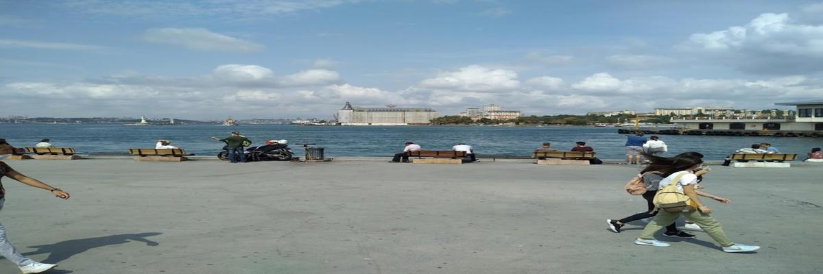
The Mediterranean Region
THE MEDITERRANEAN REGION

Geographical position
The Mediterranean Region gets its name from the sea it neighbors. The region is intruded as a strip with a width of 120 180 km, starting from around Köyceğiz in the west and near Cape Simple, which is the ending point of Hatay province in the east. With a surface area of approximately 120,000 square kilometers, it generates about 15% of Turkey's total land area. Most of the provinces of Hatay, Adana, İçel, Antalya, Isparta, Burdur and Kahramanmaraş are in the Mediterranean Region. In addition, Köyceğiz, Dalaman, Ortaca and Fethiye districts of Muğla province also enter the Mediterranean Region.
Earth Shapes
A large part of the region is covered by the Taurus Mountains and high plateaus. It is generally rugged and mountainous.
Taurus, III. They are young fold mountains connected to Alpine - Himalayan system formed in geological time. Western and Central Taurus Mountains occupy a large place in the region. The Western Taurus Mountains are located on both sides of the Antalya Bay. The Bey Mountains, Çiçekbaba and Barla Mountains lie on the west of the Gulf of Antalya in the southwest - northeast direction. Sultan Dedegöl and Geyik Mountains extend to the east of Antalya Bay in a northwest - southeast direction. The Central Taurus Mountains, starting from the north of Anamur Cape, consist of three masses extending in the southwest - northeast direction. These are Bolkar Mountains, Aladağlar, Tahtalı Mountains and Binboğa Mountains. In the Mediterranean Region, apart from the Taurus Mountains, Nur (Amanos) Mountains extend as an outer row formed by mountains extending in the direction of Hatay - K. Maraş.
The extension of the mountains parallel to the coast caused the wave erosion to be high and the abundance of cliffs on the coast.
There are plateau areas in places in the Mediterranean Region.
One of them is the Teke Plateau to the west of the Antalya Bay, and the other is the Taşeli Plateau behind Anamur Cape. The karst land covered with mountains and plateaus in the west of Antalya Bay is called "Teke Region". Teke Region and Taşeli Plateau are the most secluded places in the region. the six streams where the melting of rocks in Turkey, limestone and dolomite Despite more rainfall in areas where regional structure is widespread, so that the groundwater, the surface water leads to poor. Therefore, the population density in these places is low.
Since the mountains rise from the shore and are parallel to the shore, access to the interior can only be provided by some passages.
The main passages in the region are: Çubuk Pass connecting the Lakes Region to Antalya, Sertavul Pass connecting Central Anatolia to Silifke, Belen Pass connecting the Amik Plain to İskenderun and even Syria and Çukurova to Central Anatolia. It is the Gülek Passage that connects it. Plains in this region are accumulation areas formed by the accumulation of alluviums in their collapsed areas. The most important of these accumulation areas are the Çukurova delta plain and the Amik plain in the Hatay pit. In the west of the Mediterranean Region, on the coast, there are the small collapsed plains of the Antalya plain and the Lakes region. The Mediterranean Region is generally rugged and mountainous. 80% of the region is formed by the Taurus Mountains that run parallel to the coast and high plateaus. This situation affects the population distribution, land transportation, vegetation and tourism diversity in the region. Industrial products diversity is least affected by this situation.
Streams and Lakes
The rivers in the region have an irregular regime. Various factors have an effect on the irregularity of the river regime. These are: In the Mediterranean climate that is effective in the region, most of the precipitation occurs in winter. Summer months are very hot and dry. As a result, rivers swell in winter and dry up in summer. It is seen that karstic landforms take a large place in the region. As a result, in rainy seasons, some of the water seeps underground, preventing rivers from swelling too much. In the summer, it is observed that the groundwater mixes with the stream, preventing the water level from falling even a little.
The most important rivers of the region are Asi, Seyhan, Ceyhan, Göksu, Manavgat, Aksu and Dalaman creeks. The region is rich in lakes.
Lakes Region, where lakes formed by tectonic and karstic factors are located, is located in the west. There are lakes in Beyşehir, Eğirdir, Burdur, Acıgöl, Suğla, Söğüt, Salda, Elmalı and Kovada. Eğirdir Lake is a fresh water lake. The reason for this is that excess water discharges from underground to Aksu and therefore to the Mediterranean.
Lake Suğla, one of these lakes, suffers from water loss to dry up from time to time. Amik Lake in the Hatay region in the east is a lake where the floods of the Asi river are in the form of a swamp. This area is largely filled with alluvium brought by the streams.
Climate and Vegetation
Characteristic Mediterranean climate is seen in the region. Summers are hot and dry, winters are warm and rainy. The annual average temperature is 18 ° C. There are places on the coast where the annual precipitation amount is 1000 mm. The Mediterranean coast is our region where the winter season is the warmest. The reasons for this are the amount of humidity, the falling angle of the sun's rays and the direction and elevation of the Taurus Mountains. The Taurus Mountains prevent cold air masses from the north from landing on the shore in winter. The maximum precipitation coincides with the winter season. On the other hand, the summer drought in the region is the result of the dynamic high pressure areas being effective and the region being affected by the low air movements.
As it rises from the coast, the temperature decreases and the amount of precipitation increases. The slopes facing the sea receive abundant rainfall. In the west, around Antalya, in the east, Hatay, Dörtyol, Osmaniye, Kadirli, Bahçe area around 1000 mm of rainfall. However, Mersin and Adana surroundings on the plain receive 600 - 700 mm of precipitation. Where terrestrialization is evident, it expands in the western part of the region. Lakes region and Teke region are places where continentality is most prominent. Temperature differences increase, winters last longer. There is maquis vegetation up to 700 - 800 m in the Mediterranean Region. Maki, olive, myrtle, laurel, mastic tree, oleander, carob, etc. consists of drought resistant stunted plants. Forests in the region start after maquis and continue up to 2400 m. Then there are mountain meadows. Mountain meadows on forest areas dry up with the effect of drought in summer. As one goes towards the inner parts of the Mediterranean Region, the climate becomes continental. Especially in the Lakes Region, annual rainfall and winter temperature values have decreased.
Agriculture and Livestock
Although the agricultural areas in the region are limited, the most important economic activity on the coastline is agriculture.
The most important agricultural areas are Çukurova, Amik and Antalya plains. Climate characteristics shape agricultural life. It is our region that has the most favorable conditions in terms of purchasing more than one product from agricultural fields during the year. The main agricultural products grown in the region are:
Wheat: It is grown almost everywhere in the region. It is also cultivated in areas where cotton is not cultivated in Çukurova.
Rice: It is grown in Amik Plain, around K. Maraş and around Silifke in Hatay.
Cotton: It is grown in Çukurova and other coastal plains. Approximately 33% of Turkey's cotton production from the region.
Tobacco: It is grown in the Lakes Region and around Hatay.
Rose: It is cultivated especially around Isparta and Burdur.
Citrus fruits: They are grown along the coast in Finike, Antalya, Alanya, Anamur, Silifke, Mersin, and Dörtyol. about 89% of Turkey's citrus production from the region.
Banana: It is grown around Alanya and Anamur. Covered from all of the bananas grown in Turkey.
Poppy and sugar beet: They are especially products of the Lakes Region.
Olives and grapes: It is grown almost everywhere on the coastline. However, olive cultivation and viniculture did not develop much because the people of the region gave importance to cotton production, which is more profitable.
Area soybean, peanut and corn production in the first and in Turkey.
Greenhouse cultivation is most common in the Mediterranean region. The fact that the winter temperature in the region does not fall below zero has led to the development of out-of-season vegetables and fruits. Mersin - Antalya coastline is the place where seasonal vegetable growing is most common.
Animal husbandry has not developed much in the Mediterranean Region. Cattle, sheep and goats are raised by the transhumance system in the Taurus Mountains. The most common of the animals is the whisker. Because this animal easily survives on the steep slopes of the Taurus Mountains.
Underground Riches
Chrome: It is mined around Fethiye- Dalaman and Adana (Aladağlar).
Barite: It is mined around Mersin and Adana.
Bauxite (aluminum): It is mined around Seydişehir in the Western Taurus Mountains.
Sulfur: It is extracted around Keçiborlu (Isparta).
Iron: It is mined around Adana (Feke and Saimbeyli).
Asbestos: It is mined around Hatay in the Eastern Mediterranean.
Industry
Industry has developed further in the Adana Section. There are textiles, tobacco, food, chemicals, agricultural tools, cement, metal goods, glass and brick factories in Adana Department. Mersin is an important port city.
Ataş oil refinery is located in Mersin.
There are ferro - chrome facilities, oil factories in Antalya. Isparta has rose oil factories, cement factory, agricultural equipment production centers and carpet factory. There are rose oil factory, sugar factory, agricultural equipment factory, milk and feed factories in Burdur.
Tourism
The region ranks third in terms of revenues from tourism. Insuyu cave in Burdur, Damlataş cave in Alanya, Seven sleepers cave in Tarsus, Karain cave near Antalya, Düden, Manavgat,
Kurşunlu and Tarsus waterfalls, Heaven and Hell sinkholes in Mersin and Dilek well cave are karstic shapes in the region that cause tourism activities. In addition, the early start of summer caused the early start and development of sea tourism. Touristic facilities have been established and established along the entire Mediterranean coast. In the Mediterranean Region, there are Olympos - Beydağları Beach, Güllük Mountain (Termessos), Kovada Lake, Kızıldağ, Köprülü Canyon and Karatepe - Aslantaş national parks. Golden Orange Film Festival and Mersin Fashion and Textile Fair, which are held every year in Antalya, are also important tourism events.
Population and Settlement
According to the 1997 census, there are 8.1 million people in the region. It ranks fifth in terms of population. The population density is 66 people per square kilometer.
70% of the population in the Mediterranean Region is gathered in Adana Section.
The main reasons for this situation are;
• The existence of Çukurova, which is a rich agricultural area,
• The excess of industrial establishments processing agricultural products in Çukurova,
• Adana Section is connected to East, Southeast and Central Anatolia by roads. In the Adana Department, the active industry, agriculture and trade in large provinces and districts such as Adana, Mersin, İskenderun, Antakya, Kahraman Maraş, Tarsus, Kilis, Kozan, Kadirli, and Osmaniye caused the population to increase.
In the Antalya Section, the population constitutes 30% of the population of the region. Because;
• Antalya Plain is not as productive as Çukurova.
• Karstification with the presence of calcareous rocks adversely affects agricultural life.
• Transportation has not developed much in the Antalya Section. Burdur and Isparta regions were connected to the Aegean Region by rail and became the aftermath of İzmir.
• The population of the coastal plains of the Antalya Section has been increasing in recent years due to tourism activities. On the other hand, collective settlement is more. However, scattered settlements are encountered in regions with abundant water. Due to the prevalence of touristic facilities in the coastal plains of the region, dispersed settlement is dominant. Limestone constitutes the building material of the village and town houses in the region. Mediterranean Region shows a state under the average of Turkey in terms of population density. The most important reason for this is the Taurus Mountains, which occupy 90% of the region. Taurus, Teke and Taşeli Region, one of Turkey's most sparsely populated places. The impact of the special position in the Department of Adana population density is above the average of Turkey. Due to the cotton cultivation of Çukurova in the Adana Section, it receives seasonal migration from the Southeastern and Eastern Anatolian provinces. In Çukurova, the population increases in summer. The increase in the need for agricultural workers plays a role in this increase.
Notes on the Region;
Most peanut production,
The highest anise production,
It is the only banana growing area,
Most greenhouse cultivation,
Maximum bauxite extraction,
Maximum sulfur extraction,
The most intensive agriculture is done,
The largest alluvial plain is in the Mediterranean Region, where the most karstic shapes are seen.
Within the region;
The least and least populated places are in Taşeli and Teke peninsula.
Most hair goats are grown in Adana section.
The most important contribution of the Antalya department to the economy is Tourism.
The most important contribution of the Adana department to the economy is Agriculture. Its largest city is Adana.

